GIS Surveying
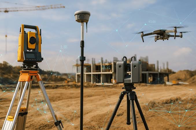
ARD Services provides professional GIS Surveying and Geospatial Solutions to government departments, municipalities, utility organizations, infrastructure companies, and private enterprises. We leverage advanced technologies such as GPS/DGPS, Total Station, Drone Mapping, Mobile GIS, and Remote Sensing to deliver accurate spatial data for planning, management, and decision-making.
Our GIS Surveying Services
Property & Asset Surveys
- GIS-based Property Tax Surveys
- Building Footprint Mapping
- Asset Inventory Surveys
- Utility Asset Mapping
- Encroachment Identification
- Land Parcel Mapping
Field Data Collection
- GPS/DGPS Surveys
- Mobile GIS Data Collection
- Ground Truth Verification
- Infrastructure Surveys
- Road and Street Inventory Surveys
- Utility Network Surveys
Drone & Aerial Mapping
- Drone Surveys and Orthophoto Generation
- Digital Elevation Model (DEM) Creation
- Contour Mapping
- Topographic Surveys
- Construction Progress Monitoring
GIS Database Development
- Spatial Database Creation
- GIS Data Integration
- Web GIS Solutions
- Asset Management Systems
- Decision Support Systems
Industries We Serve
- Municipal Corporations & Urban Local Bodies
- Smart City Projects
- Revenue & Land Administration Departments
- Water Supply & Sewerage Boards
- Power Distribution Utilities
- Telecommunications
- Transportation & Infrastructure
- Real Estate & Construction
Why Choose ARD Services?
✔ Experienced GIS and Survey Professionals
✔ High-Accuracy GPS/DGPS and Drone Surveys
✔ Advanced GIS Software Expertise
✔ End-to-End Project Execution
✔ Quality Assurance and Data Validation
✔ Timely Project Delivery
Our Commitment
At ARD Services, we transform field data into actionable geospatial intelligence. Our GIS surveying solutions help organizations improve planning, optimize resources, enhance revenue generation, and make data-driven decisions with confidence.
“Accurate Surveys, Intelligent Maps, Better Decisions.”